This past August, I had the chance to bikepack the Delaware Water Gap for the first time, but it definitely won’t be the last. I only got a glimpse of the many amazing roads, sceneries and sights that this area has to offer – and it’s accessible by train for car-less people like myself. I live in New York City, so this 3 day, 2 night bikepacking route started and ended with NJ Transit and Metro-North train rides from and to Penn Station. Make sure to check the schedule ahead of time, especially for the Port Jervis line, as it runs infrequently.
Day 1 – Dover, NJ to Stokes State Forest Campsite at Shotwell Pond
The official start of my route was in Dover, NJ. To get there, I took the NJ Transit train from Penn Station. [Tip: If the first day of your trip falls on a weekday, you can also take the train to Netcong, NJ to shave off a few hilly miles on US-46.]
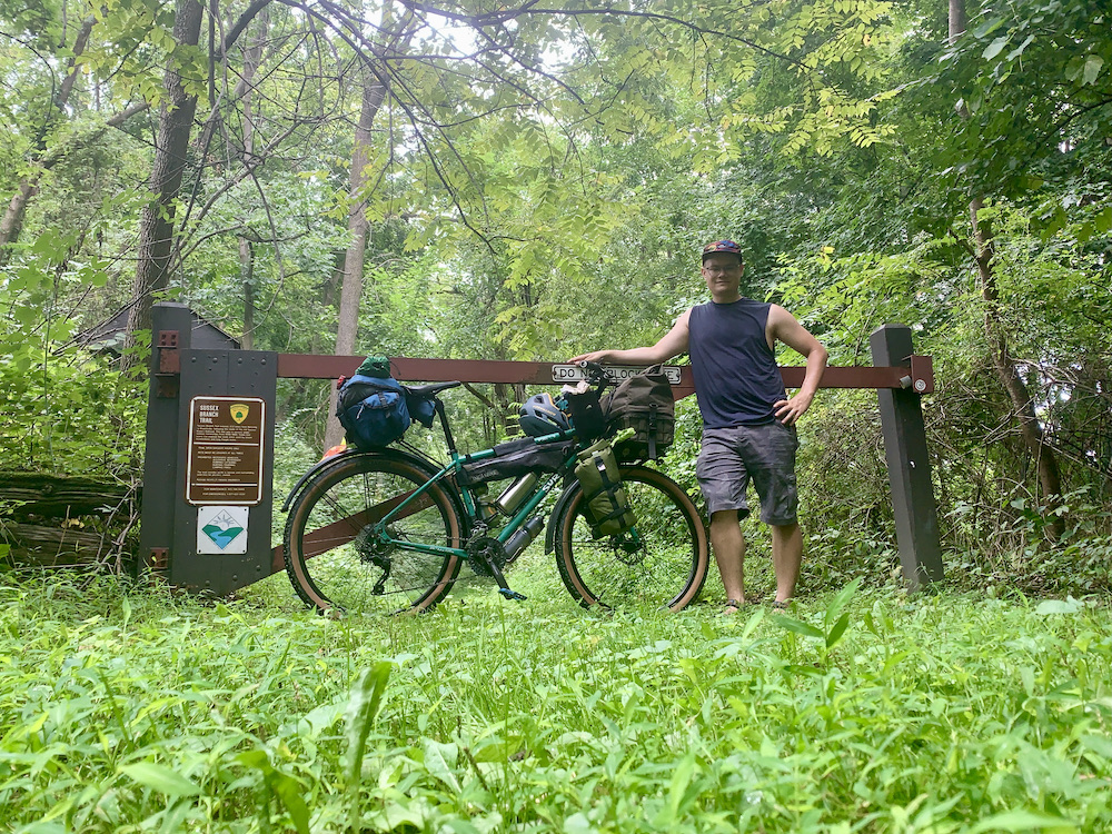
Starting in Dover, NJ, I rode west on US-46, a paved road with a generous shoulder, to Netcong. I decided to buy food and some snacks for the whole trip at the local ShopRite, because resupply options along the route would be limited without adding detours. After another mile or so on Love Lane I reached the scenic Sussex Branch Trail, which would take me off-road all the way to Branchville, NJ. Parts of this trail is wide and well maintained with a gentle pitch while other parts are flat, rocky, and overgrown single-track.
Once in Branchville, I headed north on US-206, where I had a delicious lunch at The Carriage House. I sat in their outdoor area overlooking Culver Lake, which I recommend! This stretch of businesses would also be the last chance to grab any additional supplies before heading into the woods. There was one more hill to climb before reaching Stokes State Forest, where I spent night 1 at the serene Shotwell Camping Area.
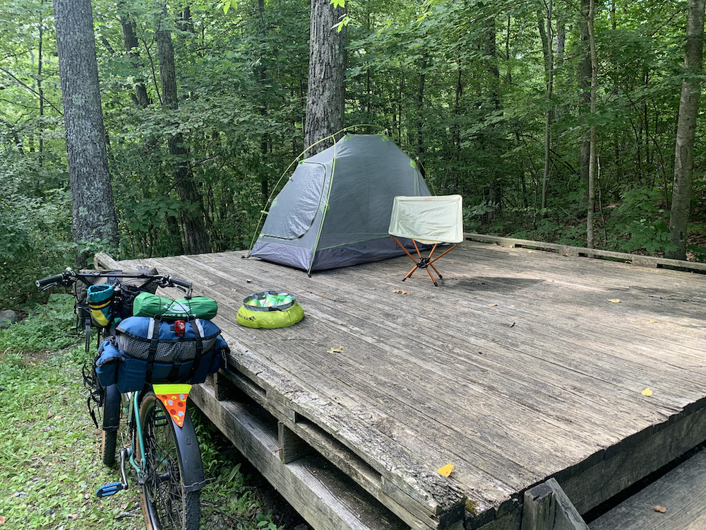
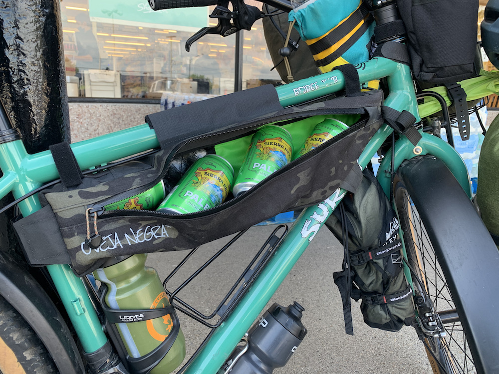
From the Park Office – check in here if you arrive before 4PM, otherwise do that the next morning – it was another 10 minutes on the bike to reach my campsite. The site was secluded and wonderfully quiet, in the middle of the forest. After setting up camp, I spent the rest of the day relaxing at the campsite and enjoyed a few ice-cold Sierra Nevada Pale Ales, a yummy reward after a hot and hilly day on the bike. Total mileage for Day 1 was 38 miles with 1,876 ft of elevation gain.
Day 2 – Stokes State Forest, NJ to Dingmans Campground, PA
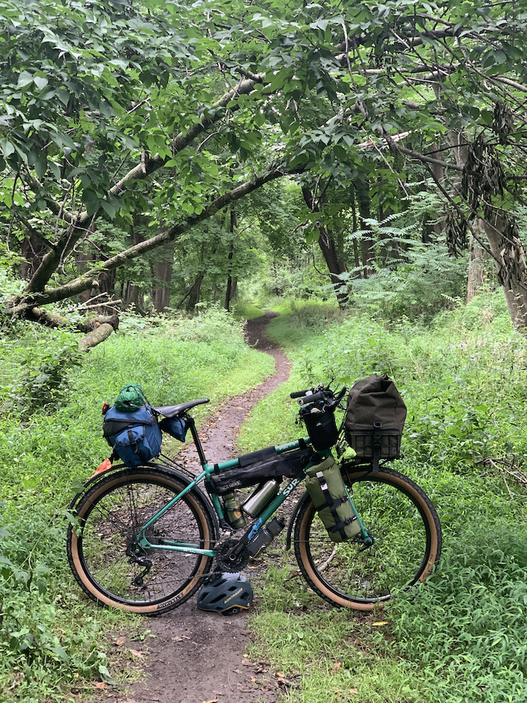
I got up right around sunrise, made some coffee and enjoyed the early morning hours in the forest – what a treat for a stressed out New Yorker! After breakfast I broke down camp, departed the campsite and headed south-west, deeper into the woods on quiet roads past ponds, cabins and towering trees. Where Stokes State Forest ends, the Delaware Water Gap National Recreation Area begins.
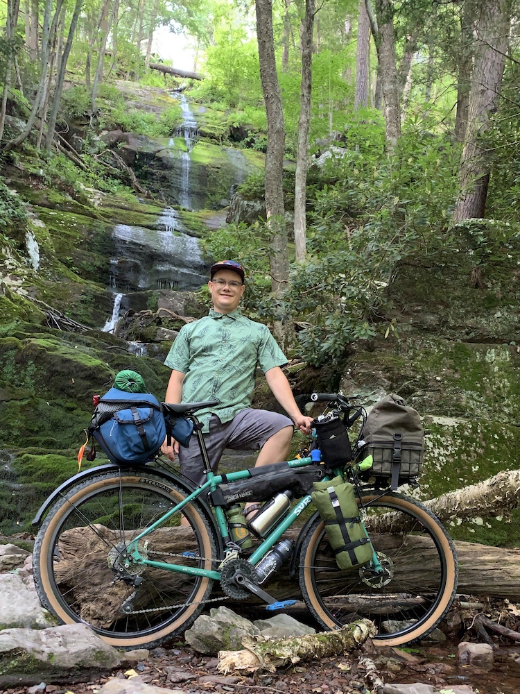
Gravel roads that are closed off to cars took me past waterfalls and countless hiking trails branched off these roads with plenty of opportunities to explore the area further. 14 miles into the day, I reached Old Mine Road, a beautiful, scenic road that’s been in use for centuries. Running parallel to the Delaware River, it carried me into Worthington State Forest in the Northwestern corner of New Jersey.

After crossing the I-80 bridge into Pennsylvania, I reached the town of Delaware Water Gap right around lunchtime. Here, there are a few options for lunch (pizza, BBQ, bakery), but the closest supermarket is in Stroudsburg, which requires a detour over an additional hill both ways. Now heading east, after a few miles on River Road, I reached the McDade Recreational Trail that runs about 31 miles along the river through woods and farmland. There are several rest stops with boat launches, bathrooms and spots to refill your water along the way.
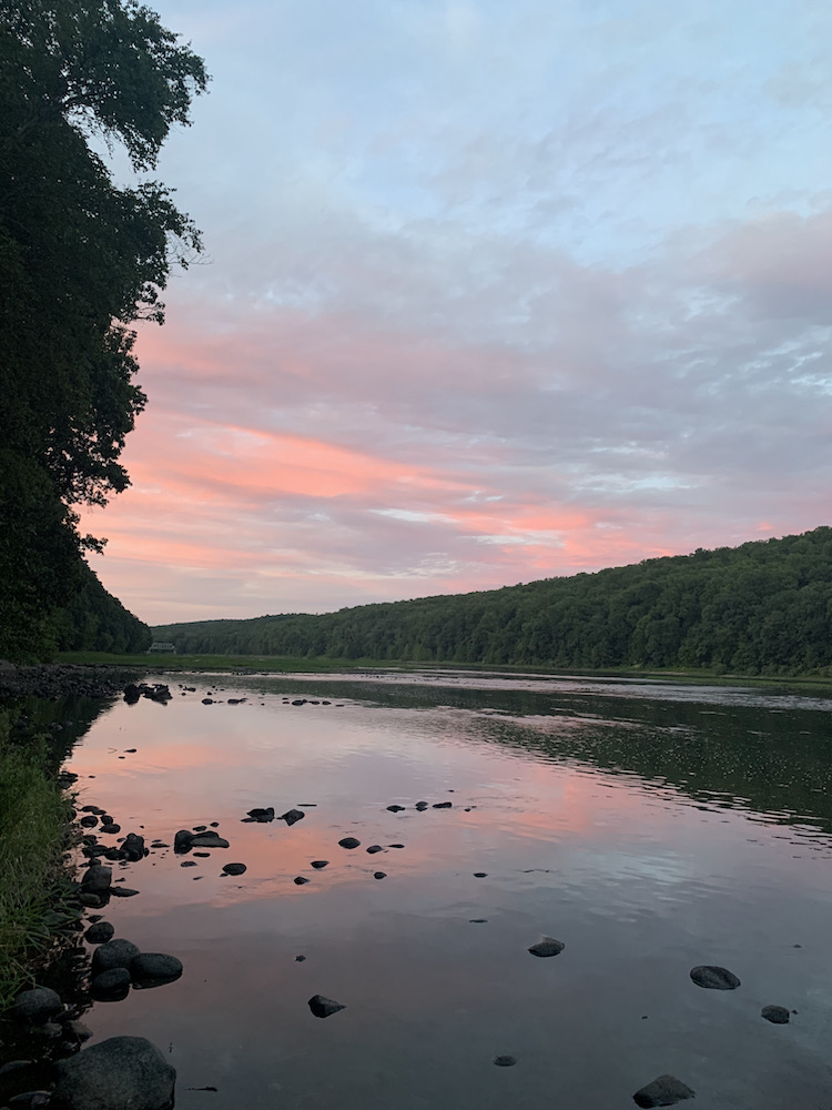
Right on the trail, just outside of Dingmans Ferry is Dingmans Campground, where I spent night 2. I splurged on a river-adjacent site and it was well worth it. A little trail led to the water, so I could wade directly into the calm river to cool off after a full day on the bike – it was wonderful. After a much needed shower, I set up camp and cooked myself some dinner. I spent the rest of the evening enjoying a few beers both by the river watching a magical sunset and around the campfire I built with wood that the campground provided free of extra charge. What a fantastic day of bikepacking! Total mileage for Day 2 was 54 miles with 3,327 ft of elevation gain.
Day 3 – Dingmans Campground to Port Jervis, NY
First order of the day was coffee that I enjoyed sitting on some rocks by the river – both a serene and invigorating way to start the day. After breakfast, I packed all my gear and left the campground. I got back on the McDade Trail and rode to Millford, PA, where the trail ends. Tip: along this stretch are several more waterfalls that would make great additional destinations! I took US-209 the rest of the way to Port Jervis, NY, where I caught the train back to NYC. Make sure you know the train schedule ahead of time, as the Port Jervis line runs infrequently. Total mileage for Day 3 was 17 miles with 639 ft of elevation gain.
Tips & Tricks for Bikepacking the Delaware Water Gap
Here are some tips and tricks to make this trip extra fun:
- There are so many other fun things to do along this route in the Delaware Water Gap. If you have the time, consider adding another night or two to the trip to do some hiking (on the Appalachian Trail and/or countless other trails), kayaking/boating, birding or check out the many awesome waterfalls along the route!
- Stop to take pictures and enjoy the gorgeous scenery frequently. It’s easy to get lost in the riding if you have a lot of miles to cover, but make sure to slow down and explore 🙂
- A few parts of the route are on roads. While there is a generous shoulders there is also a good amount of car traffic, so make sure to have a day-time rear blinky light and/or something reflective to be extra visible.
- Pack a water filter! I didn’t end up using mine, but I was glad to have it as a back-up option in case you’re running low on water.
- I do not suggest this route for absolute beginners. You need to be fully self-supported (resupply options are very limited), comfortably navigate through areas of the forest without cell reception (use of GPS device recommended) and be able to do a medium-heavy amount of climbing per day – the roads you’ll take are gorgeous, but not flat.
- Speaking of flat, make sure you know some basic bike repair or travel with a skilled buddy so you don’t get stranded because of a mechanical.
- Tires of at least 38mm or wider are recommended for comfort. Some gravel sections of the ride are rather rocky and you’ll appreciate the extra cushion
- Bears are common in the areas you will travel through, so make sure you have a plan for safe food storage at camp.
*this route traverses land of the Susquehannock and Lenape peoples.