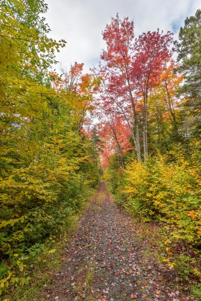
Ah, fall. What a wonderful time to be in the Northeast. The oppressive summer heat is subsiding, the blistery winter cold hasn’t yet arrived, and the trees are treating us to one of the most glorious annual spectacles nature has to offer.
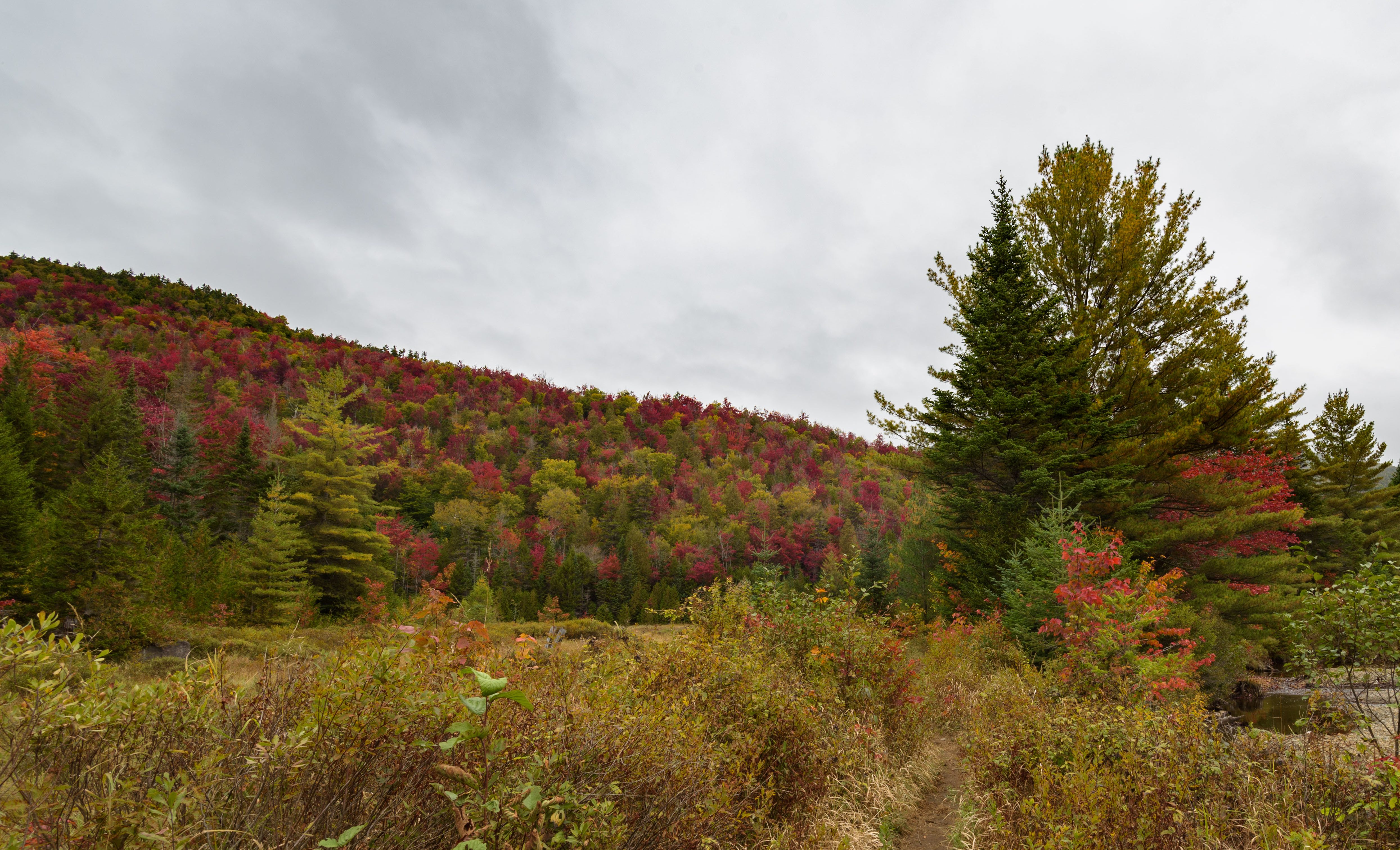
And if you have a real passion for, or interest in, exploring the backcountry, there is no better time to do so than during the mild, bug-free days of this season. Being a real backcountry enthusiast myself, with a girlfriend who has never camped but was eager to try, I couldn’t wait for the opportunity to subject… I mean, introduce… her to the awesomeness that is trading in the concrete jungle for raw nature. So that’s exactly what we did on this easy-to-moderate three day, two night hike in the Eastern High Peaks region of the Adirondacks.
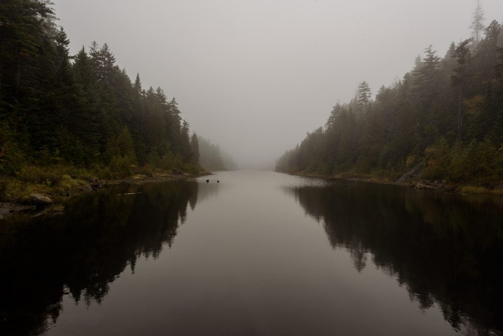
The trip was designed to be a good beginner’s backpacking trip with just enough challenge to keep it fun. We would hike 6 miles per day on average, with the option to summit one of the many surrounding peaks on day 2 that give the region its name. Once you pick up your maps from the Adirondack Mountain Club, and you’ve got your required bear canister full of food, figure out how to acquire a car to get you there. Then you can park in the southern lot of Upper Works Road and make the short and scenic roadside hike north to the Upper Works Trailhead. For the most part, day 1’s hike is a slight and gradual uphill which parallels the Calamity Brook all the way to the Flowed Lands Pond. When you reach the pond you will find plenty of lean-tos and two primitive campsites just north of the Upper Works Trail’s end, where you will want to make camp. You won’t be disappointed by the view here of the pond and the surrounding mountains, but if you’re feeling adventurous and time is on your side, you can continue about a mile further to a group of additional lean-tos and primitive campsites that surround Lake Colden. Also make sure you resist the urge to start that prohibited fire in camp!
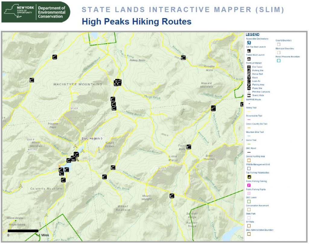 On day 2 you have all sorts of mountain summits available at your fingertips – from Mount Marcy, NY state’s tallest mountain at just over a mile high (5,344 ft.), to Mount Marshall, Iroquois Peak, Algonquin Peak, and more. Get an early start, go for a summit, and start making your way back in the direction of your first night’s campsite when done. If you only make it halfway up the summit and have to turn back because you took your time or too many pics (guilty!), that’s OK too.
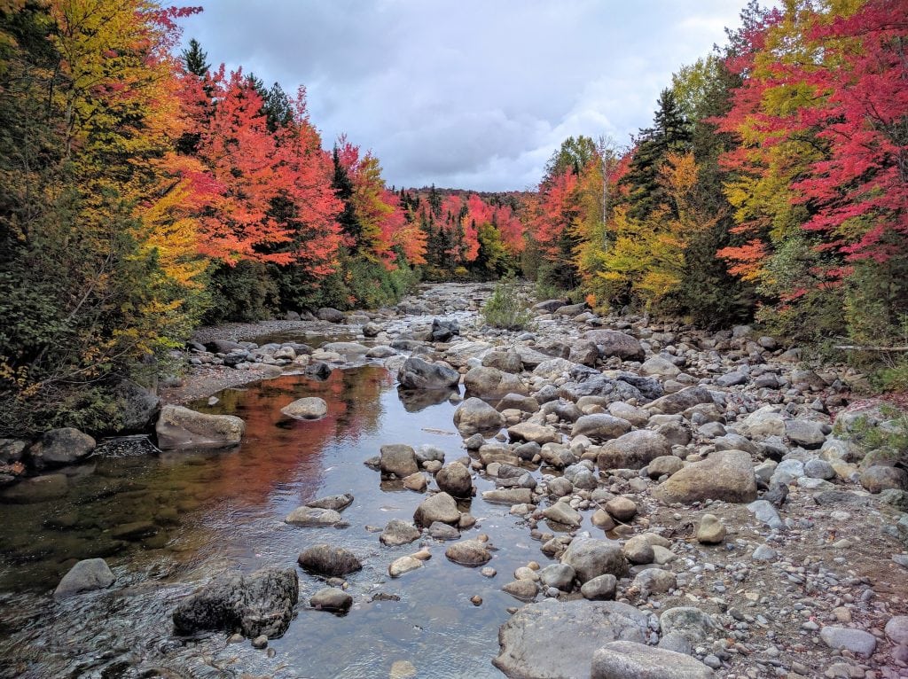
Bypass the Upper Works Trail that brought you here to the red marker trail that first crosses the Opalescent River, and then follows south alongside it.
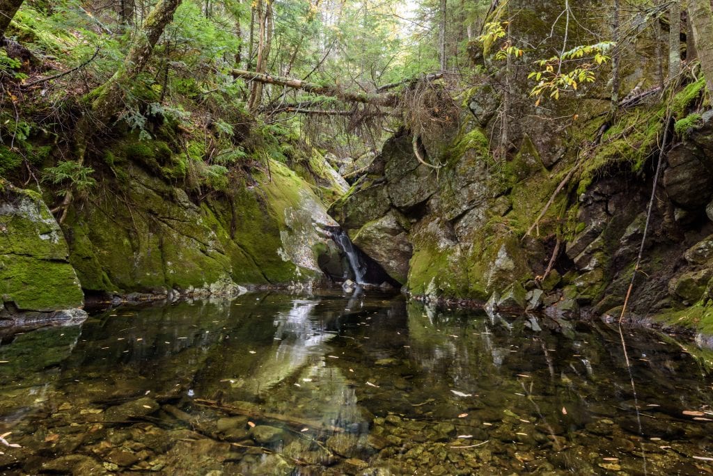
You will eventually see an old primitive campsite on the right side of the trail just about two miles from the Flowed Lands campsite. Get your rest here to the calming sounds of nearby flowing water, assuming you’re the type who prefers that over ambulance sirens and loud music.
Day 3 features a few doable inclines and declines, some really nice views of the Opalescent River, and an interesting detour if you make the wrong turn! Unless you would like an unplanned trip towards Mount Allen on your way home, make sure you turn right after crossing the Upper Twin Brook, not left towards the sign that is clearly labeled “Allen” (rookie mistake!). Resist the urge to later summit Mount Adams unless you have the time, energy, and hiking experience. And lastly, enjoy your last river crossing over the makeshift bridge just before reaching the parking lot. Believe it or not, you are crossing the very early beginnings of the Hudson River! You can now tell your friends you crossed the Hudson on foot, and not over the GWB. #exclusive
Written and photographed by Izzy Lopez, @BronxNomad