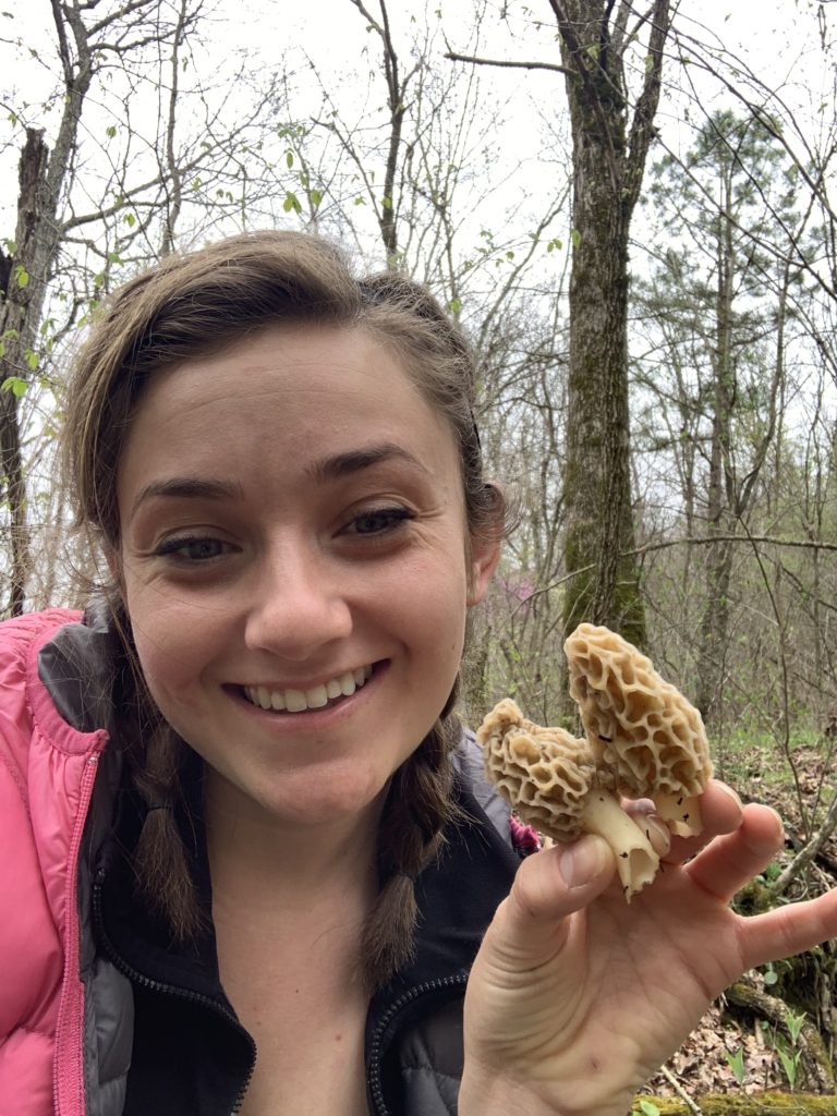
It’s morel season so this month’s map highlights where to go to find some tasty mushrooms. As always, make sure you know what you’re doing before you eat a wild mushroom. Scroll down to find books, blogs and videos to learn more!
This is our NWA Map of the month for April! This is a special trail because it is where our NWA chapter leader, Carly Gurel, first learned about the wonderful world of morel hunting (and nabbed her first shrooms!)
Park in the field at the bottom of the hill, if your car has any trouble with the dirt road you can also park at the top and follow the road down to the field. The trail starts through the field at the far end of the clearing.
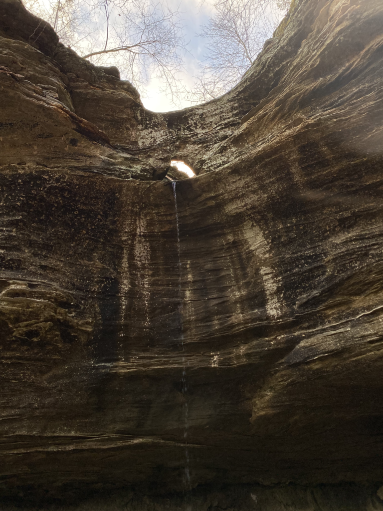
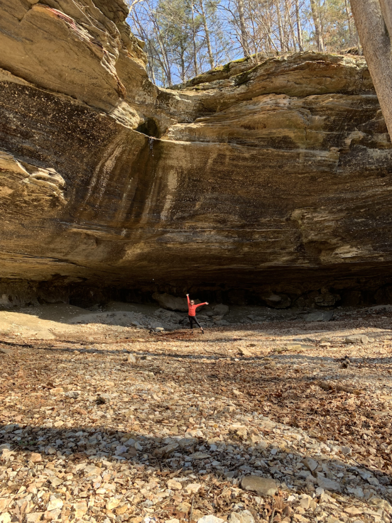
The Falls really only flow during or after a big rain! See if you can be lucky enough to spot the water shooting straight out of the Tea Spout, a 46 foot fall with an eroded hole in the bluff so water shoots straight out!
The trail can be hard to find, making it a good hike (or bushwhack) for foraging. Less visited = more chance of hitting foraging gold! This is an out and back trail, about 2 miles round trip.
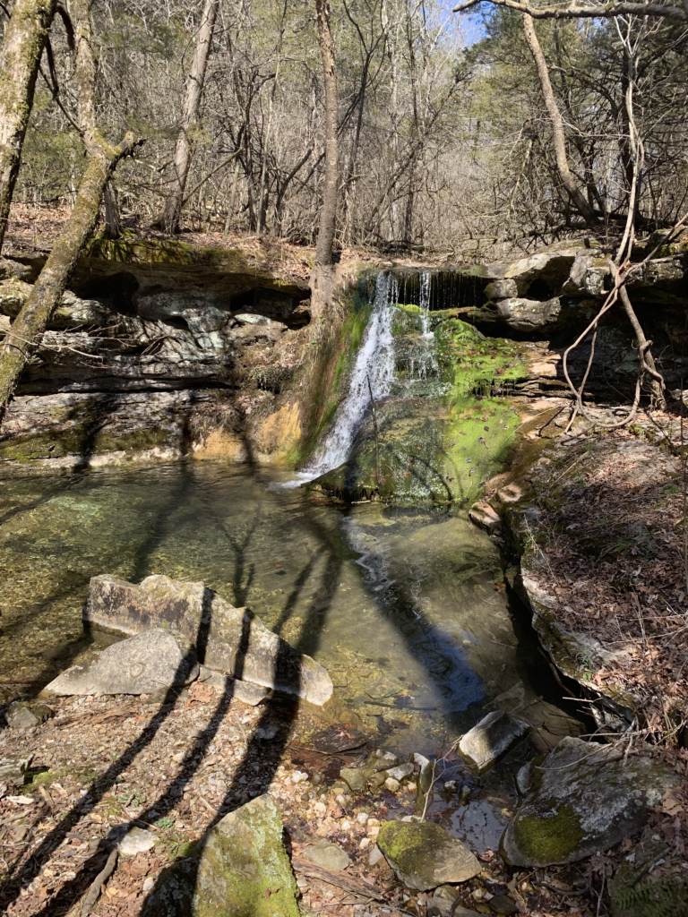
On a warm summer day you can also wear your sandals and follow the creek bed.
This is in the McElroy Game Management Area and near the Kings River, explore more while you are out this way, there is a lot to see! (The Kings River Overlook is a highlight)
More Resources for Foraging in the Ozarks
Tree Identification:
- How to identify sycamore (Platanus occidentalis) | TREE ID #8
- Tree identification: American elm
- How to Identify an Elm Tree From the Bark [Morel Hunting]
- 7 Trees Every Mushroom Hunter Should Know
Books:
- Foraging the Ozarks: Finding, Identifying, and Preparing Edible Wild Foods in the Ozarks
- Trees, Shrubs, and Woody Vines of Arkansas
- Wild Edible Plants of Arkansas
Blogs for Foraging: