Thanks to Mappy Hour member Christy for sharing one of her latest fall backpack’s with us for Seattle’s Map of the Month.
This month’s hike features a recent backpacking trip along the Chain Lakes Loop trail within the Mount Baker Wilderness Area. While this trail can also be accomplished as a moderate day hike, this trail can be extremely busy in October and early fall. Splitting the route into two makes for an easy overnight backpack that allows you to experience the colorful landscape at different times of day and with less people.
Chain Lakes Loop Backpack Trip:
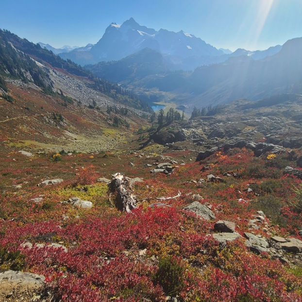
Chain Lakes Loop is a very popular day hike that loops through the Mount Baker Wilderness Area, especially in the early fall. The trail is a bit of a “choose your own adventure” in the sense that there are multiple potential starting points and two directions. For this backpacking trip, we chose to start from the Heather Meadows Visitor Center and travel counterclockwise. The trail starts along Bagley Lakes and includes crossing a small stone bridge, before the steady climb of around 1400 feet up to Herman Saddle. In October, the slopes were covered in foliage with brilliant green, red, yellow and purple colors and offered spectacular views of Mount Shuksan.
Day 1 Map of the Chain Lakes Loop:
Day 2 Map of the Chain Lakes Loop:
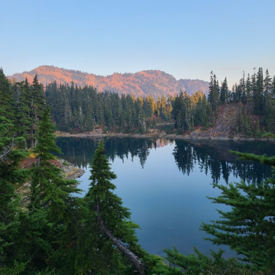
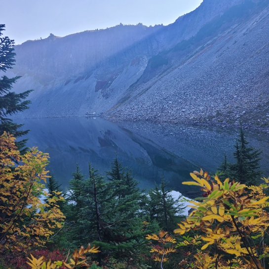
After crossing the saddle, the trail then drops down into the lakes area and consists of multiple options for camping. We ended up finding a site near Hayes Lake and arrived around noon. It is recommended that you arrive early to get a good campsite as there were a steady stream of backpackers rolling in after we set up our site. This area does not require permits, so makes it popular for backpacking as well. Note that the designated camp sites are located in a strip of land between Hayes and Arbuthnot Lakes as well as some on the backside of Mazama Lake. Mazama Lake has a stream and small falls running on the west side of the lake. The ranger recommended protecting food from bears, so we brought bear canisters with us on this trip. All of the sites had great views of the lakes and surrounding hills and multiple sites had places for stringing hammocks! Sunset colors were particularly spectacular, and the campsite had optimal viewing of the night’s sky.
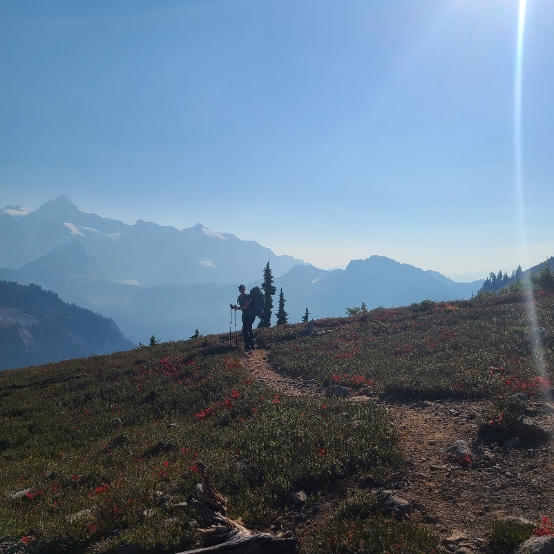
The next morning we packed up around 9 AM and began the gentle climb up to the start of the Ptarmigan Ridge. Although the route was pretty exposed, it offered spectacular views of Mount Baker as well as spotting pikas! Around 11AM many day hikers were on the trail, and we found the Artist’s Point parking lot full and bustling. From the parking lot we continued down the Wild Goose Trail back to the Heather Meadows parking lot where we began the day prior. This part of the trail is not quite as enjoyable since it is close to the road and also contains a section of vertical steps to go down. Our group was particularly happy to have completed the Chain Lakes loop counterclockwise for this reason! To enjoy the fall colors as we did, the hike has to be completed before the snow hits, which tends to begin at the end of October.
Tips for hiking Chain Lakes Loop
- Get to the trailhead early to ensure a space in the parking lot. We began hiking at 10am and the parking lot at Heather Meadows was almost full. If it is, though, don’t sweat as there is additional parking near the Austin Pass picnic area
- If you have an extra night, hike along Ptarmigan Ridge and camp at Camp Kaiser located at the base of Mt. Baker’s Sholes Glacier
- If you need an extra challenge, there are a number of additional hikes you complete after dropping your pack at your campsite, including one to Mazama Falls and on top of Table Mountain
- Skip the final section of the Wild Goose Trail by staging a car at Artists Point parking lot, before starting the hike from Heather Meadows
Driving Directions to the Chain Lakes Loop:
While there are many starting points, the trailhead for the route we took starts at the Heather Meadows Visitor’s Center. The road is easily accessible by all vehicles and a National Park Pass is required. There are a couple fairly large parking lots near Heather Meadows Visitor Center and Artist Point. Vault toilets are available at both trailheads. More details about this hike can be found at the WTA website here.